Tutorial 2 of 6
Import data and choose coordinate systems
Beginner 8 min
Add GeoJSON, shapefiles, KML, GPX, CSV, WKT and TopoJSON to a map, read CSV files with Swiss or UTM coordinates, and show coordinates in the system you work with.
GISela reads the common vector formats: GeoJSON, shapefiles (as a ZIP with .shp, .shx, .dbf and ideally .prj), KML and KMZ, GPX, CSV with coordinate columns or a WKT column, plain WKT and TopoJSON. Use File → Open or add files… (Ctrl+O), Add data above the layer list, or drop files onto the map.
Coordinate systems
Coordinates come in many systems. GPS and web maps use WGS 84 longitude and latitude in degrees. National maps often use metres on a projection: Swiss LV95 (EPSG:2056), the British National Grid (EPSG:27700), German Gauss–Krüger zones, or UTM zones. GISela stores every layer in WGS 84 and converts on import and export, with its own implementation of each projection.
GISela detects the system when the file says it:
- a shapefile's
.prj(by EPSG code, by name or by its projection parameters), - the older
crsmember of a GeoJSON file.
KML and GPX are always WGS 84. For everything else — most often CSV files — you choose the system in the import dialog.
Example: bus stops in Swiss coordinates
The file bus_stops_lv95.csv has five stops with columns stop;E;N;boardings, for example Bus Seefeld;2643240;1219692;640. Drop it onto the map. GISela recognises the CSV, guesses the columns N (northing) and E (easting), and asks for the coordinate system. Choose CH1903+ / LV95 (EPSG:2056) and press Add to map.
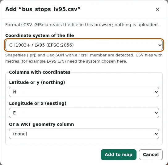
The status line confirms: Added 1 layer with 5 features. Coordinates were converted from CH1903+ / LV95 (EPSG:2056) to WGS 84. The first stop lands at 8.008505° E, 47.126804° N.
If you leave the system on Detect and the numbers are far larger than degrees can be, GISela warns that the file is probably in a projected coordinate system and asks you to choose it.
Show coordinates in your system
View → Project settings… sets the project's coordinate system. It is used for the coordinate readout in the status bar and as the default for exports. Any system from the list works, and Other EPSG code… accepts the code of any UTM zone (326xx north, 327xx south) or ETRS89 UTM zone (258xx).
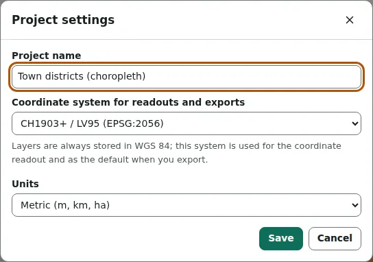
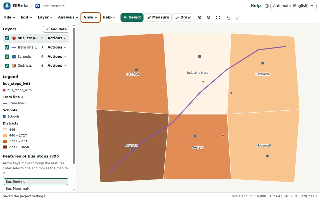
With LV95 chosen, the status bar shows E 2,643,340.2, N 1,220,233.7 instead of degrees.
Accuracy
Projections are exact to the millimetre (they are checked against the published worked examples of Ordnance Survey, IOGP and swisstopo). Changing the datum — for example from the Swiss or British reference frame to WGS 84 — uses the official seven-parameter transformations, which are good to about one to a few metres. Survey-grade work needs the national grid transformations (NTv2, OSTN15), which GISela does not include. ETRS89 is treated as equal to WGS 84; in Europe the two differ by well under a metre.
Ready to try it?