Tutorial 1 of 6
Your first map in five minutes
Beginner 5 min
Open a GISela template, find your way around layers, legend and map, select features with the mouse or the keyboard and keep your project in this browser or in a file.
GISela is a geographic information system — a GIS — that runs in your browser. A project holds layers; every layer holds features of one kind: points, lines or polygons. Each feature has a geometry (where it is) and attributes (what it is: a name, a population, a date). Files you open are read on this device and are not uploaded.
Start from a template
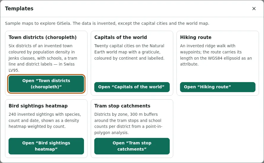
Choose File → Templates…. There are five sample maps:
- Town districts (choropleth) — six districts of an invented town coloured by population density, with schools and a tram line
- Capitals of the world — twenty capitals on the world map, coloured by continent
- Hiking route — an invented ridge walk with four waypoints
- Bird sightings heatmap — 240 invented sightings shown as a density surface
- Tram stop catchments — 300 m zones around tram stops and school counts per district
The data is invented, except the positions of the capital cities. The world map shows Natural Earth country outlines.
Layers, legend and map
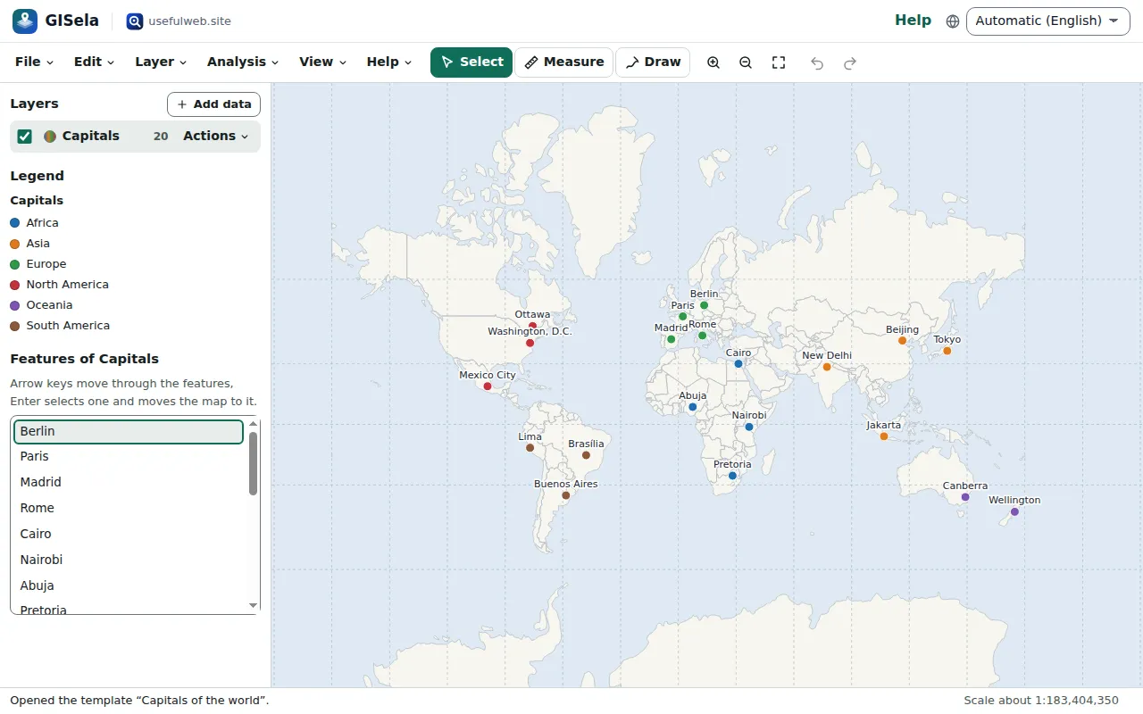
The panel on the left lists the layers. The top layer is drawn last, so it sits on top. The tick box shows or hides a layer, the name selects it, and Actions opens the layer menu: style, attribute table, filter, zoom to layer, move up or down, rename, duplicate, export and remove.
Under the layers, the legend explains the colours of every visible layer. Below that, Features of … lists the features of the selected layer.
Move around
Drag the map to pan, use the mouse wheel or + and − to zoom, and 0 to show all layers. Double-clicking the map zooms in. When the map has the keyboard focus, the arrow keys pan.
The status bar at the bottom shows the approximate scale and the coordinates under the pointer. View → Project settings… chooses the coordinate system of that readout — for example Swiss LV95 or a UTM zone.
Select features
With the Select tool (key V), click a feature. Its attributes appear in the side panel, its outline turns red, and the status line says what was selected — screen readers read that line too. Shift-click adds more features.
Without a mouse, use the feature list: move through it with the arrow keys, and Enter selects a feature and moves the map to it. Everything on the map can also be reached through the list and the attribute table.
Saved automatically
GISela saves every change in this browser a moment after you make it; File → Recent projects… lists what is stored here. File → Save project file (Ctrl+S) writes a .gisela.json file that you can open on any other device with File → Open or add files…. Undo (Ctrl+Z) and Redo (Ctrl+Shift+Z) work for every change.
Ready to try it?