Tutorial 4 of 6
Attribute table, filters and the field calculator
Intermediate 8 min
Sort and edit attributes, filter features with expressions, compute new fields such as density, and join a CSV table by a key.
The attribute table shows one row per feature and one column per field. Select a layer and press T, or choose Layer → Attribute table. It opens below the map.
Sort, select and edit
Click a column heading to sort, click it again to reverse. The button in the first column selects the feature and moves the map to it; Shift adds to the selection. Edit opens all attributes of a feature in a dialog; a double-click on a value edits it in place (Enter saves, Escape cancels). Add field… and Delete field… change the columns; Export CSV downloads the table.
Filters
A filter hides features that do not match an expression. Choose Filter… in the table or Layer → Filter features… and write, for example:
zone = 'residential' AND population > 1000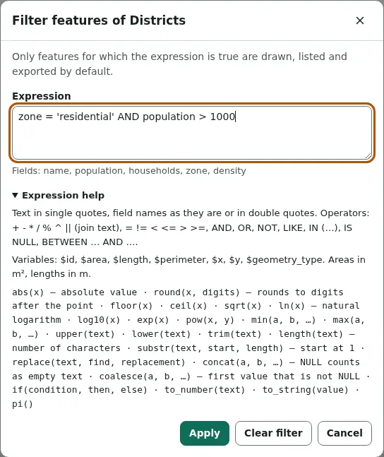
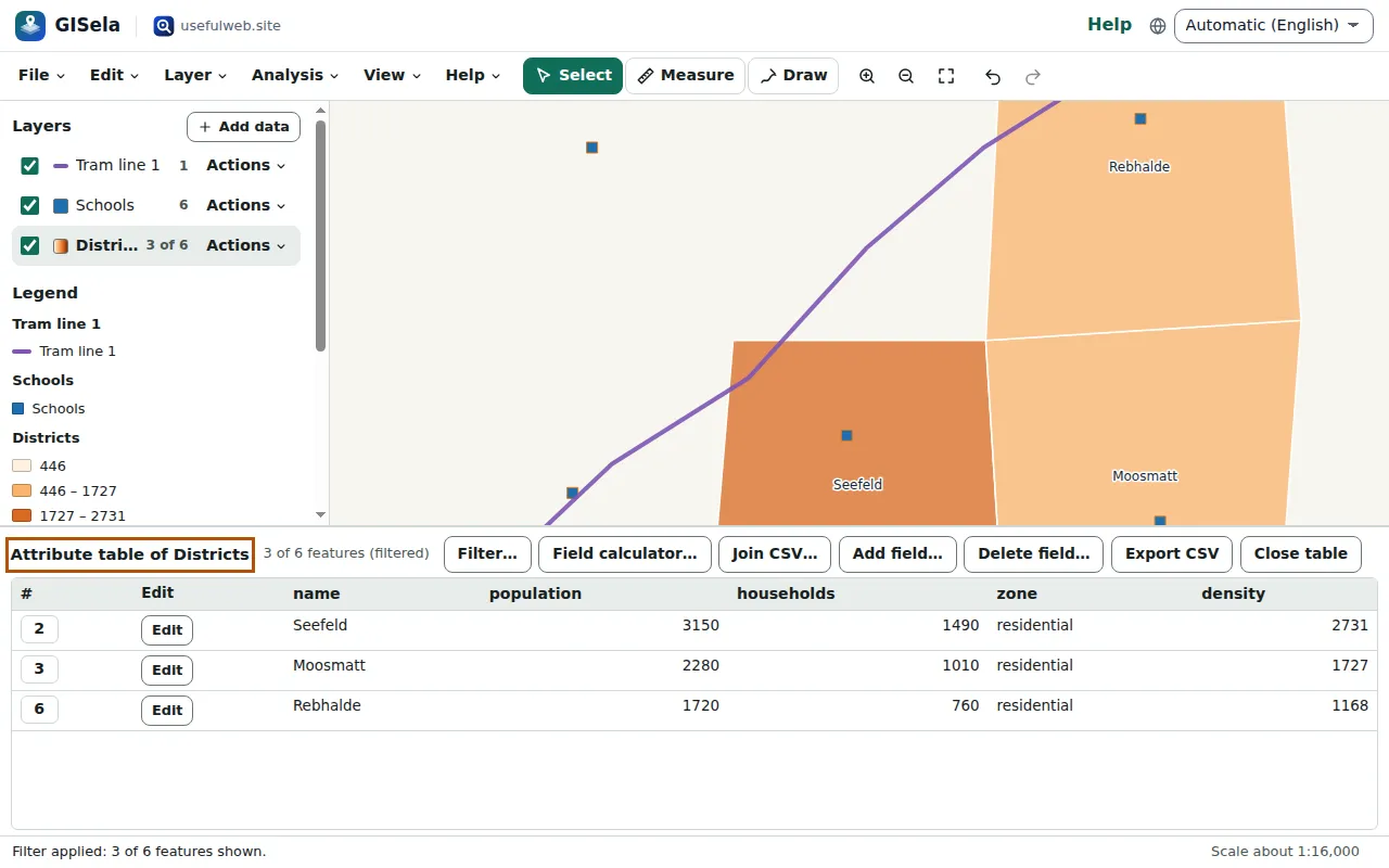
The map, the feature list, the table and exports by default then only show the matching features. In Town districts, three of six districts match: Seefeld, Moosmatt and Rebhalde. The layer list shows 3 of 6.
The expression language
Expressions work like SQL or QGIS:
- text in single quotes (
'mixed'), field names as they are or in double quotes ("Name with space"); + - * / % ^,||joins text, comparisons= != < <= > >=;AND,OR,NOT,LIKE 'A%',ILIKE,IN ('a', 'b'),IS NULL,BETWEEN 1 AND 3;- functions:
abs,round,floor,ceil,sqrt,ln,exp,pow,min,max,upper,lower,trim,length,substr,replace,concat,coalesce,if,to_number,to_stringandpi; - geometry values
$area(m²),$length(m),$perimeter(m),$x,$yand$id.
Empty values are NULL: NULL + 1 is NULL, and a comparison with NULL is neither true nor false. Expressions never run JavaScript; an unknown field or function is reported with its position.
Field calculator
Field calculator… writes the result of an expression into a new or existing field. For population per square kilometre:
round(population / ($area / 1000000))The dialog shows the first five results before you calculate; for Altstadt that is 3650. $area is measured on the WGS 84 ellipsoid, so the result is correct in any coordinate system. Tick Only the selected features to update part of a layer.
Join a CSV table
Join CSV… adds columns from a table to the features whose key matches — for example mayors or school counts per district name. Choose the key field of the layer and the key column of the CSV; numbers are recognised, and the status line says how many features matched and how many did not.
Ready to try it?